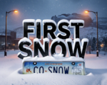
Colorado’s high country is staring down a powerful early-season storm that will slam the mountains with heavy snow and create dangerous travel conditions starting Wednesday. Winter Storm Warnings and Advisories are already in place, with some areas north of I-70 expecting up to 20 inches of snow through Thursday.
The northern mountains and favored passes like Rabbit Ears, Vail, and Berthoud are getting hit hardest. Drivers planning to cross the Continental Divide Wednesday night into Thursday morning should prepare for major delays, chain requirements, and possible pass closures.
Winter Storm Warning Zones Could See Up to 20 Inches
The National Weather Service has issued a Winter Storm Warning for the Park Range, Elkhead Mountains, and areas around Steamboat Springs from 6 AM Wednesday to noon Thursday.
Forecasters say 6-15 inches are likely across most of these zones, with isolated higher elevations picking up as much as 20 inches. Rabbit Ears Pass on Highway 40 will be particularly hard hit.
This much snow in less than 36 hours will create whiteout conditions and snow-packed roads that even experienced drivers struggle with.

Winter Weather Advisory Covers Much of Western Slope High Country
A broader Winter Weather Advisory stretches from the Grand Mesa and Elk Mountains to Vail Pass and the Gore Range.
Snow totals here will generally range from 6-10 inches above 9,000 feet, with 1-4 inches possible in high valleys like Aspen. The San Juan Mountains will see lighter amounts, mostly 1-4 inches with some peaks getting 6-10 inches.
Travel over Monarch, Red Mountain, and Wolf Creek Passes will turn difficult Wednesday afternoon and stay treacherous through Thursday morning.
Valley Rain Chances Increase Wednesday Night
Lower elevations will stay mostly rain, though a few spots could mix in wet snowflakes Thursday morning as colder air moves in.
Grand Junction, Montrose, Delta, Cortez, and Moab all have chances for scattered showers Wednesday afternoon, with the best rain window coming Wednesday night into early Thursday.
Most valley locations will pick up less than a quarter inch of rain, but some spots could see closer to half an inch. That is enough to make roads slick when combined with falling temperatures Thursday morning.
Temperature Drop Arrives Thursday
Wednesday will actually feel mild for mid-winter standards. Highs will climb into the mid-50s across the Western Slope under cloudy skies.
The cold front slides through Thursday morning, dropping highs into the 40s with gusty north winds. That sharper air will help change rain to snow in the foothills and push snow levels down to around 7,000 feet by Thursday afternoon.
Travel Impacts Will Be Significant
CDOT is already warning drivers that Wednesday night through Thursday morning will be the worst window for mountain travel.
Vail Pass, Rabbit Ears Pass, and Berthoud Pass are all likely to require chains or alternate traction devices for commercial vehicles. Passenger vehicles should carry winter emergency kits, extra food, water, and blankets in case they get stuck.
Ski areas like Steamboat, Winter Park, and Copper Mountain are celebrating the natural snow dump, but access roads will be slow and chain controls are almost certain Thursday morning.
The storm wraps up Thursday afternoon, with only scattered snow showers lingering into Thursday night. Dry and colder weather returns for the weekend, perfect for enjoying whatever fresh powder sticks around.
This early punch of winter serves as a sharp reminder that mountain weather can change fast in Colorado. Locals know the drill, pack patience, check CDOT and weather apps before heading out, and give snowplows plenty of room.
Stay safe out there, Colorado.
What is this storm doing to your plans? Drop your thoughts below and tag #COwx if you share photos or videos of the snow on social media.


