Scientists have uncovered astonishing evidence of an ancient continent buried beneath Antarctica, thanks to newly recovered data from a long-defunct satellite. The findings, made possible by gravity-mapping technology, offer a rare glimpse into Earth’s geological past and reshape our understanding of Antarctica’s history.
Satellite Data Unlocks Antarctica’s Hidden Past
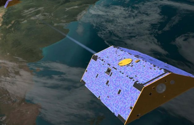
For decades, Antarctica’s geological history has remained elusive, largely hidden beneath miles of ice. Now, thanks to the European Space Agency’s (ESA) Gravity field and Ocean Circulation Explorer (GOCE) satellite, researchers have mapped out remnants of an ancient landmass deep below the frozen continent.
GOCE, which was operational from 2009 to 2013, was designed to measure Earth’s gravity field with unparalleled precision. Though the satellite itself has long since burned up upon re-entry, its stored data has continued to yield groundbreaking discoveries. Using GOCE’s gravity measurements, scientists have reconstructed details of Antarctica’s lithosphere—the rigid outer layer of the planet’s structure.
A Glimpse Into a 200-Million-Year-Old Supercontinent
The research, published in Scientific Reports, details how Antarctica once belonged to the supercontinent Gondwana. This vast landmass, which also included present-day Australia, India, and Africa, began breaking apart roughly 180 million years ago. As the continents drifted to their modern positions, Antarctica became isolated and eventually developed its ice-covered landscape.
Satellite data confirmed that East Antarctica shares ancient geological traits with India and Australia, providing further evidence of its former connection to these regions. Researchers identified cratons—fragments of ancient continental plates—buried more than a mile beneath the ice. These cratons, also found in Australia and India, offer proof that East Antarctica was once geologically linked to them.
Surprising Differences Between East and West Antarctica
While East Antarctica showed clear signs of its ancient connections, West Antarctica told a different story. Unlike its eastern counterpart, West Antarctica lacks these cratons due to its thinner lithosphere. This suggests that West Antarctica evolved separately and had a different geological history than the more stable East.
According to Fausto Ferraccioli, a lead researcher at the British Antarctic Survey, the findings highlight the stark differences between the two regions. “In East Antarctica, we see an exciting mosaic of geological features that reveal fundamental similarities and differences between the crust beneath Antarctica and other continents it was joined to until 160 million years ago,” he said.
Gravity Imaging: The Key to Unlocking Earth’s Secrets
The breakthrough would not have been possible without the innovative use of gravity imaging. Since traditional methods struggle to penetrate Antarctica’s thick ice sheets, gravity measurements provided a unique way to analyze what lies beneath the surface. The data revealed not only geological features but also how these landmasses have moved over millions of years.
- The research condensed 200 million years of movement into a 24-second video, illustrating how Antarctica separated from Gondwana and shifted to its current position.
- These findings could help scientists predict future changes in Antarctica’s ice sheets and how shifting landmasses might influence climate patterns.
The Future of Antarctic Exploration
With each new discovery, Antarctica’s past becomes a little clearer. While GOCE has been gone for more than a decade, its contributions continue to shape our understanding of Earth’s geological history. As researchers refine their models using these data, we may uncover even more hidden secrets beneath the ice.
For now, the lost continent beneath Antarctica serves as a striking reminder of how much remains to be discovered about our planet’s deep past. And with advancements in satellite technology, this is likely just the beginning.