Western Colorado and eastern Utah are welcoming back sunny skies after a week of much-needed rain that eased drought conditions but did not end them. The storm system, which delivered healthy moisture from Tuesday through Saturday, has moved east, leaving behind clearer weather and hopes for more relief in this dry 2025 fall season.
Storm System Brings Relief to Parched Areas
The recent weather pattern shifted dramatically last week, bringing storms that soaked much of western Colorado and parts of eastern Utah. Rainfall helped firefighters battle ongoing wildfires and gave a boost to local water supplies strained by months of heat.
In Grand Junction, the airport recorded 0.68 inches of rain over those days, pushing the year’s total to 3.36 inches. That still leaves the area 2.85 inches below normal, but it marks a step up from earlier deficits. Montrose saw 0.57 inches, bringing its annual total to 3.38 inches, which is 2.23 inches short of average.
Other spots fared better. Durango topped the list with 1.13 inches, while most regions got between half an inch and an inch. This moisture came at a critical time, as wildfires have scorched parts of the region amid a hot summer.
Experts note that while this rain helps, it is just a drop in the bucket for long-term recovery. Climatologists point out that consistent wet weather is key to reversing trends seen since exceptional drought returned to Colorado in August 2025, the first time since 2023.
Drought Conditions Get a Temporary Boost
Drought remains a big concern across western Colorado, with the latest U.S. Drought Monitor update on September 11 showing extreme levels in central and northern areas, stretching down through the San Juan Mountains. Severe drought grips the southwest and Four Corners region.
The recent rains should improve the picture in the next update, set for Thursday. Officials say areas like Garfield County, hit hard by extreme drought affecting over 99 percent of its population since August, could see some easing.
However, experts warn that one wet week will not fix months of dry conditions. Hot, dry summers have sapped rivers, fueled wildfires, and hurt fall colors in places like Garfield County, where leaves may turn early or lack vibrancy due to stress on trees.
- Key drought impacts include reduced water for farming, higher wildfire risks, and strained reservoirs.
- Recent storms brought flash flooding in some spots, a reminder that heavy rain can cause problems even as it helps drought.
Local farmers and ranchers welcome the moisture, which could help late-season crops and pastures. Yet, with the region still classified as severe to extreme drought, more rain is needed to build up snowpack for winter, especially in the San Juans where early melt-offs have been an issue.
Rare Tornado Touches Down in Utah
Adding to the week’s wild weather, a tornado struck San Juan County, Utah, on Saturday near Montezuma Creek. Radar picked it up around 12:30 p.m., and local emergency teams confirmed it shortly after.
The National Weather Service rated this twister as an EF2, with peak winds of 122 mph. It marks the first such strong fire whirl tornado since 2020. A survey team is assessing damage and path length, which could take days.
This event ties into broader severe weather, including thunderstorm warnings and hail reports near Grand Junction. No major injuries were reported, but it highlights how shifting patterns can bring unexpected threats.
Communities in the area, from Moab to Cortez, stayed alert amid tornado warnings. Such events are rare in this rugged terrain, but climate shifts may increase their frequency.
Forecast Points to Dry and Warm Days Ahead
Looking forward, the region shifts to drier conditions with plenty of sunshine. Evening skies will clear, with temperatures dropping to the low 50s overnight in many spots.
Monday brings warmer weather under sunny skies. Highs will reach the low to mid-80s, with Grand Junction hitting around 83 degrees and Moab up to 86 degrees.
| Location | Overnight Low | Monday High |
|---|---|---|
| Grand Junction | 53°F | 83°F |
| Montrose | 47°F | 81°F |
| Delta | 49°F | 87°F |
| Cortez | 42°F | 80°F |
| Moab | 54°F | 86°F |
The week ahead looks seasonable, with no major storms in sight. This dry spell could help with outdoor activities but might worsen drought if it drags on. Keep an eye on updates, as fall can bring quick changes.
What This Means for Residents and Visitors
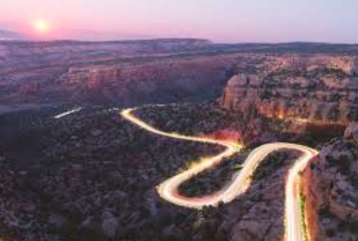
For locals, this weather mix offers a breather after stormy days but underscores the need for water conservation. Tourists planning hikes in the Grand Canyon or San Juan areas should check forecasts, as monsoonal patterns can still pop up with showers or thunderstorms.
Recent events tie into larger trends, like the smoky haze from wildfires earlier this month that cleared with the rains. Staying prepared for flash floods or sudden storms remains wise in this variable climate.
Share your thoughts on how this weather has affected you, or comment below with your drought stories to join the conversation.