News
Colorado Braces for Rain and Mountain Snow Monday
Colorado residents are gearing up for a mix of rain in the valleys and snow in the mountains starting Monday. This weather system, moving in from California and Nevada, brings much-needed precipitation after a dry December, with potential travel hazards in higher elevations.
Weather Alerts Issued Across the State
A Winter Weather Advisory takes effect from 5 AM Monday to 5 AM Tuesday for northern Colorado mountains, including the Park and Elkhead ranges near Steamboat Springs. Forecasters warn of 4 to 8 inches of snow, with gusty winds up to 40 mph causing low visibility and slick roads.
This alert highlights risks for drivers on high passes and the Continental Divide. Similar warnings cover other areas like the Grand Mesa and Uncompahgre Plateau, where heavier snow could accumulate.
Recent reports show this storm follows a pattern of warmer-than-average temperatures in late 2025, which left snowpack levels low. Experts note that while this event won’t fully fix the deficit, it offers some relief to ski areas struggling with below-normal snowfall.
Forecast Details for Rain and Snow
The system arrives early Monday, with valley rain starting between 2 AM and 5 AM. Mountains will see more steady snow throughout the day, tapering off by evening.
In lower elevations like Grand Junction and Montrose, expect occasional rain showers with totals under a quarter inch. Higher peaks could get 6 to 12 inches, especially in the Elk Mountains and Park Range.
Temperatures will stay mild, with highs in the mid-40s to low-50s in valleys. By contrast, mountain areas will hover in the 30s, supporting snow accumulation above 6,500 feet.
Data from recent storms shows similar patterns brought 1 to 4 inches to central mountains last week, boosting totals slightly but still leaving resorts under 70 inches for the season.
Forecasters predict the heaviest impacts in northern regions, where blowing snow may reduce visibility to under a quarter mile.
Expected Snowfall and Rainfall Amounts
Snowfall varies by elevation and location, based on the latest models.
- Northern mountains near Steamboat Springs: 6 to 12 inches possible.
- Grand Mesa and Uncompahgre Plateau: 2 to 6 inches, with peaks up to 12 inches.
- San Juan Mountains: Less than 3 inches, as the storm tracks north.
- Central mountains: 1 to 4 inches generally, 3 to 7 inches on higher summits.
Rainfall in valleys remains light, mostly below 0.25 inches, helping ease drought concerns without flood risks.
| Region | Expected Snow (inches) | Expected Rain (inches) | Wind Gusts (mph) |
|---|---|---|---|
| Northern Mountains | 4-12 | N/A | Up to 40 |
| Central Mountains | 1-7 | N/A | 20-30 |
| Southern Mountains | 0-3 | N/A | 15-25 |
| Valleys (e.g., Grand Junction) | N/A | <0.25 | 10-20 |
This table summarizes projections, drawing from national weather service updates.
Travel and Safety Impacts
Travelers should prepare for difficult conditions, especially in the High Country. Roads like those over mountain passes may become snowpacked, with poor visibility from blowing snow.
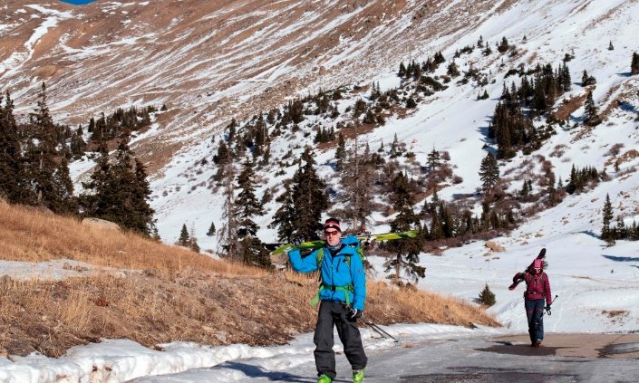
Ski resorts welcome the fresh powder after a warm December that set records in places like Denver and Grand Junction. However, avalanche danger rises in areas expecting over a foot of snow, such as the Elk and West Elk ranges.
Residents in affected areas are advised to check road conditions before heading out. Recent events, like last week’s light snow that added 1 to 4 inches, showed minor disruptions but highlighted the need for caution.
In urban spots like Denver, the day stays mild with highs in the low 60s and breezy conditions, but no major precipitation.
Broader Weather Trends in Colorado
This storm fits into a shifting pattern after an unseasonably warm end to 2025. December averages hit 42.3 degrees in some areas, just shy of 1933 records.
Snowpack remains poor statewide, with no resort topping 70 inches this season. Incoming storms could double some figures, aiding water supplies and winter sports.
Experts link these trends to broader climate shifts, with more variable precipitation expected. Another system may follow mid-week, bringing additional snow.
Communities rely on these events for reservoirs and agriculture, especially after dry spells.
What to Expect in the Coming Days
Monday’s weather clears by Tuesday, leading to drier conditions mid-week. A second storm could arrive later, potentially adding more snow.
Temperatures hold steady in the 40s to 50s in valleys, with colder air in mountains. Keep an eye on updates for any changes.
For the latest, monitor local forecasts and prepare accordingly.
Share your experiences with this weather in the comments below, and pass this article along to help others stay informed.

Two Teams Build the First Working Thorium-229 Nuclear Clocks

Earliest Flickering Quasar Found 850 Million Years After the Big Bang

Birmingham Physicists Build a 24,000-Atom Mini-Universe to Test Time

Humans Have a Counterclockwise Walking Bias, and It Spans Cultures

Venus Flytrap Snap Solved: Cell Walls Soften, Not Water, Study Finds

The Former SpaceX Welder Whose $10,000 Stock Grant Became $1,046,175

Siri AI Compatible Devices: The Full List and the 12GB Catch

GameStop Pro Points End in 2026, But the $25 Fee Stays

Pokemon Go Player Scans Now Power Military Drone Navigation Tech

New Warhammer 40,000 Event Companions Lock In One Force Disposition

Subnautica 2 Studio Apologises, Holds Line on No-Kill Combat

Brent at $111 Hides the Hormuz Damage Hitting Fed and Asia

Shai Gilgeous-Alexander Wins Second Straight MVP With 83 of 100 First-Place Votes

Mitchell Matches Kobe in Game 7 Rout, Cavaliers Reach East Finals

Xperia 1 VIII Holds Price, Xiaomi 17 Max Loads Up: Week 20 Phone News

Colt Emerson Debuts, Mariners Get Swept by Padres in Vedder Cup

Rousey Finishes Carano in 17 Seconds and Hands Netflix Its MMA Opening

Samsung Strike Looms May 21 as Union Eyes SK Hynix Bonus Formula

Jaylen Brown Calls Stephen A. Smith the Face of Clickbait Media

LIRR Strike Hits Third Day as 250,000 Commuters Face a Tougher Manhattan Run
-

 TECHNOLOGY3 years ago
How to Adjust a Bulova Watch Band – An Easy Guide
-

 News3 years ago
Fred Pentland: Athletic Bilbao’s English mentor who changed the essence of Spanish football
-

 FINANCE3 years ago
Tax Planning for Every Season: Guide to Maximizing Your Tax Benefits
-

 Education3 years ago
African Ministers New Education Plan
-

 BUSINESS3 years ago
What is Entrepreneurial Operating System? A Comprehensive Guide to EOS
-

 Education3 years ago
Innovate Your Learning Journey with Technology and Enhance Education
-

 News3 years ago
Russians formally out of World Athletics Championships
-

 BUSINESS3 years ago
Top 9 Most Expensive American Cities to Rent an Apartment