Grand Junction, Colorado, woke up to steady rain on Christmas Day 2025, bringing much-needed moisture but disrupting holiday plans for many. With temperatures climbing into the upper 50s and low 60s, the unseasonably warm weather turned the morning into a soggy start, though forecasts promise drier conditions by afternoon.
Morning Rain Soaks Holiday Start
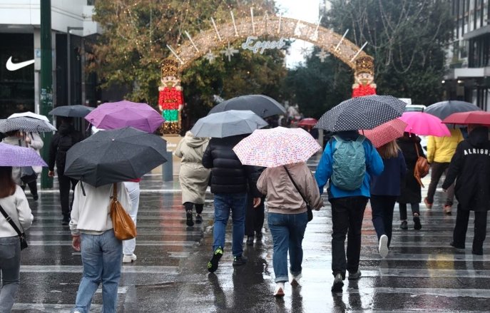
Rain began overnight and picked up intensity by dawn, affecting outdoor gatherings and travel across western Colorado. Local residents reported wet roads and rising creek levels, with some areas seeing light showers mixed with fog.
This weather pattern stems from a moisture stream moving into the region, leading to scattered rain in valleys and snow in higher elevations. By mid-morning, rain chances hovered around 70 percent, making it tough for families to enjoy traditional outdoor activities like park visits or light displays.
Experts note this fits a broader trend of warmer Decembers in the high desert, where average highs usually sit in the low 40s. This year, the heat wave has pushed records, with some spots nearing 60 degrees.
Temperature Spikes Break Records
Highs today are expected to reach 58 degrees in Grand Junction, 57 in Montrose, and up to 63 in nearby Moab, Utah. These numbers shatter typical Christmas expectations, where cold snaps often bring snow rather than rain.
- Grand Junction: 58 degrees, cloudy with rain easing by noon.
- Montrose: 57 degrees, possible mountain snow nearby.
- Delta: 60 degrees, brief showers likely.
- Cortez: 55 degrees, cooler but still mild.
- Moab: 63 degrees, warmest in the region.
This warmth comes from a persistent high-pressure system, delaying the usual winter chill. Compared to last year’s cooler holiday, this shift has locals adapting plans, like moving barbecues indoors.
Forecasters warn that while the afternoon may dry out, isolated showers could linger over hills, adding uncertainty for evening events.
Mountain Snow Adds Travel Risks
Higher peaks, such as the San Juan and Elk Mountains, face snow accumulation through early afternoon, with up to a few inches possible above 10,000 feet. This contrasts with valley rain, creating slippery conditions on passes.
Travelers heading to ski areas or family visits should prepare for winter driving, including chains and extra time. Recent storms have already caused minor delays, and today’s mix could worsen visibility.
| Location | Expected Snow | Travel Impact |
|---|---|---|
| San Juan Mountains | 2-4 inches | Moderate delays on roads |
| Elk Mountains | 1-3 inches | Slick passes, possible closures |
| Western Slope Valleys | Minimal to none | Wet roads, low flood risk |
No major incidents have been reported yet, but officials urge caution, especially for those crossing from Colorado into Utah.
Weekend Forecast Brings More Changes
Rain tapers off by Friday, but a new system arrives that night, boosting chances for widespread showers into Saturday. Valley areas might see rain turn to light snow by evening if colder air moves in.
Sunday promises clearer skies and sunshine, with highs dropping slightly to the mid-50s. This shift could help recover from the wet holiday, offering better conditions for post-Christmas outings.
Looking ahead to New Year’s Eve, dry weather is likely, though clouds may build. New Year’s Day could turn rainy again, so plans for fireworks or parties should stay flexible.
Broader Impacts on Local Life
The unusual warmth has mixed effects, from aiding drought relief with added rain to challenging winter sports businesses reliant on snow. Farmers welcome the moisture after a dry fall, but some worry about flood risks in low-lying spots.
Community events, like light parades, adjusted schedules to avoid the morning downpour, showing resilience among residents. This weather echoes patterns seen in recent years, where climate shifts bring more rain than snow to the region.
Share your Christmas weather stories in the comments below, and pass this article along to friends facing similar conditions. Your input helps us cover what matters most.