
NEWS
Ice Left Stonehenge’s Altar Stone on a Drowned Country
Ice may have carried Stonehenge’s Altar Stone from Scotland only as far as drowned Doggerland, leaving people a 400 km haul, and perhaps two moves.

The Stonehenge Altar Stone, a 6,000 kg sandstone slab, may have ridden ice only as far as drowned Doggerland. A 4 June 2026 study from Sheffield Hallam University and Curtin University finds no ice path that reaches Salisbury Plain.
If glaciers dumped the rock on Dogger Bank in the North Sea, people still faced a 400 km haul. They may have had to move the stone twice, first to keep it from the rising sea, then toward the henge.
The Altar Stone’s Scottish Fingerprint
The recumbent sandstone at the centre of the circle is the monument’s odd one out, a grey-green slab about 4 metres long and the heaviest of the stones archaeologists still group with the bluestones. Those smaller igneous pillars came from Wales. The big sarsen arches came from Wiltshire. This one did not.
In August 2024, a Curtin-led team published a Scottish origin for the Altar Stone in Nature, matching mineral ages in zircon, apatite and rutile grains to the Old Red Sandstone of the Orcadian Basin in northeast Scotland, about 700 km (435 miles) from the site. The sandstone formed as sediment in a Devonian lake. Anthony Clarke, then the graduate student who ran the clocks and now co-lead of the new work, had shown that the grain ages do not match southern Britain.
The follow-up paper, “From Highlands to Henge: Refining the Provenance and Transport Pathways of Stonehenge’s Altar Stone,” ran in the Journal of Quaternary Science, volume 41, pages 888 to 895. It tries to narrow the bed inside that large basin and to test ice as a carrier. Sandstones from Caithness give the closest match in zircon age structure, the authors write, yet the exact outcrop is still open. The bluestones were the first stones set at the monument, and they predate the sarsen arches by about 2,000 years, so this foreign slab belongs to the early, long-distance phase of the build.
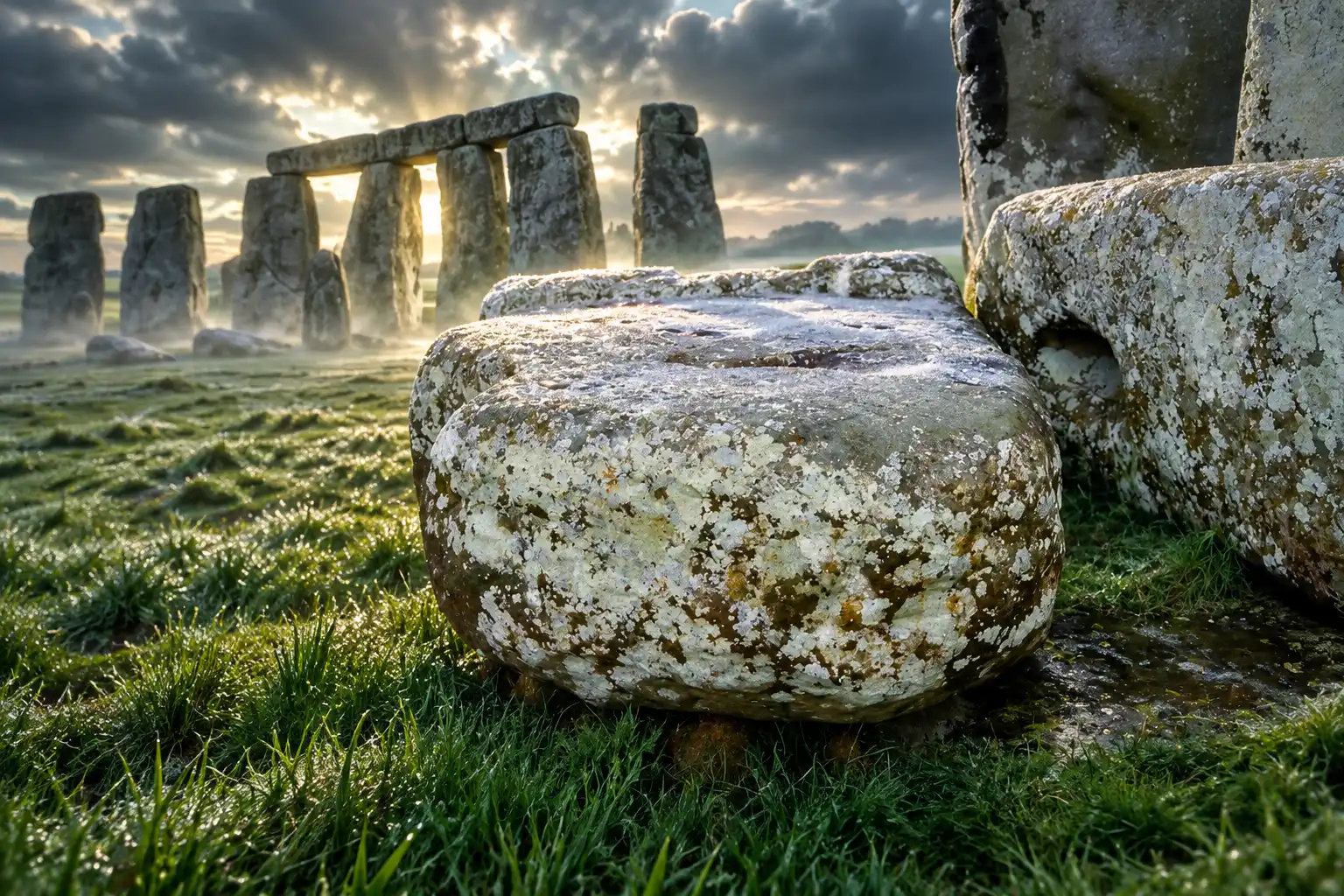
Ice Could Carry It Only to Dogger Bank
Dr Remy Veness, a glaciologist at Sheffield Hallam University and co-lead author, has spent years on a numerical model of where ice dumps erratics, the boulders a glacier picks up and leaves far from home. Ice covered the north of Britain until about 15,000 years ago, thick enough to flow like a slow river and to carry rock with it. The team asked whether that flow could have shifted Orcadian Basin sandstone closer to Wiltshire.
Most modelled paths from Caithness run north-east, the wrong way for Stonehenge. A localised south-east route points at Dogger Bank, the high ground of the drowned North Sea plain. The bank is in part a glacial moraine, a ridge of debris at the end of an ice conveyor, and Sheffield Hallam’s release says ice flows may have deposited the stone at Dogger Bank during the last ice age. That layover would cut the human leg from 700 km to 400 km. It would not finish the job.
HOW FAR EACH STONE STILL HAD TO TRAVEL
| Stone | Likely source | Distance to the henge |
|---|---|---|
| Sarsen uprights and lintels | West Woods, Wiltshire | 24 km |
| Welsh bluestones | Preseli Hills | 225 km |
| Altar Stone, direct from Scotland | Orcadian Basin | 700 km |
| Altar Stone, after a Dogger Bank layover | North Sea bank, then overland | 400 km still by people |
Archaeologist Mike Parker Pearson has documented the sarsen and Preseli figures in that range; the Altar Stone distances come from the 2026 ice study. Southern beds in the same Scottish basin would sit more comfortably on a southbound ice stream, yet they match the zircon fingerprint more weakly. The chemistry and the ice do not want the same outcrop.
Why Doggerland People May Have Moved It Twice
Doggerland was the low plain that once joined Britain to mainland Europe, now under the southern North Sea. Veness notes that it had no natural rock outcrops, so any large stone there had already travelled. Dogger Bank stood as a high point, later an island, on a floor littered with ice-moved boulders. A grey-green slab the size of a small van would not have looked local.
What is exciting about these findings is that they could imply that the people of Doggerland attached cultural significance to the Altar Stone long before it was incorporated into Stonehenge. Hypothetically, the Altar Stone could have been significant enough to be willing to move the stone at least twice; First to potentially save it from being submerged by rising sea levels at the end of the last ice age and then again to its final resting place on Salisbury Plains.
Dr Remy Veness, co-lead author, Sheffield Hallam University
Neolithic stoneworkers were picky. They chose specific rocks for tools and for monuments, and a foreign boulder on a treeless bank would have advertised itself. The ice-layover idea only works if someone valued that advertisement enough to drag 6,000 kg of it off a shrinking island.
WHY THE SLAB WOULD HAVE STOOD OUT
- No bedrock: The drowned plain had no natural outcrops, so a large sandstone block had to be an import.
- A moraine dump: Dogger Bank is partly a glacial ridge, a scatter of northern rocks left where the ice stalled.
- Choosy builders: People of the period selected stone with care, which makes an out-of-place slab a likely prize rather than clutter.
- Rising water: The same families who used the bank watched it turn from land bridge to island to seabed.
That reading is a model, not a recovery. The paper does not produce the Altar Stone from the sea floor, and a matching boulder under the North Sea has not been named. Direct carriage from Scotland, by coast and river, stays in play. What the ice step changes is the cast. It puts a vanished North Sea community between Caithness and Wiltshire, with a reason to act before their ground went under.
The Sea Took Doggerland Long Before Stonehenge Rose
Veness writes that Doggerland stayed above water until around 8,000 to 9,000 years ago, perhaps as late as 7,000. Stonehenge’s first phase, the earthwork and early stone settings, begins in 3080 to 2950 cal BC. On those dates the bank was already flooded before the henge’s builders opened the ditch. The 2026 paper calls this a temporal problem: ice can shorten the map and still miss the calendar.
FROM ICE TO THE HENGE
- About 15,000 years ago: Ice leaves northern Britain, after a period when it could have carried Orcadian sandstone as far as Dogger Bank.
- About 8,000 to 9,000 years ago: The North Sea drowns Doggerland, with the bank perhaps lasting as an island toward 7,000 years ago.
- 3080 to 2950 cal BC: Stonehenge’s first phase begins on Salisbury Plain, after the bank is already under water.
- 2580 to 2475 cal BC: The sarsen circle goes up, centuries after the early bluestone settings.
- 4 June 2026: The Journal of Quaternary Science paper is published, testing ice as a partial carrier and leaving the human miles in place.
If the stone sat on Dogger Bank, people had to lift it while dry land remained, then keep it on the English side for a span longer than the later monument’s own building sequence. That is not a one-season haul. It is an object held through a change of country, then taken west when a new monument wanted it. Collaborators on the study include the University of Sheffield, Wessex Archaeology and the University of Bristol, a mix of ice modelling and field archaeology built for that kind of broken timeline.
Salisbury Plain Lay Beyond the Ice
Dr Anthony Clarke, of the Timescales of Minerals Systems Group in Curtin’s School of Earth and Planetary Sciences, is blunt about the southern end of the map. The models allow a North Sea dump. They do not allow a free ride onto the chalk.
The research indicates there were no viable glacial pathways linking the source region directly to Stonehenge, reinforcing the conclusion that human transport was required.
Dr Anthony Clarke, co-lead author, Curtin University
The same no viable glacial pathways to Stonehenge line is the load-bearing result. Earlier work had already undercut the old idea that ice sheets simply parked foreign megaliths on Salisbury Plain. This paper tests the new Scottish source against ice-flow reconstructions and still finds the last hundreds of kilometres on people, by overland hauling with river or coastal legs where they existed.
WHAT WE KNOW
- The fingerprint: Grain ages tie the Altar Stone to Orcadian Basin sandstone in northeast Scotland, about 700 km from the henge.
- The ice limit: Models can take rock from that basin to Dogger Bank; they cannot take it into southern England.
- The human remainder: Even with a North Sea layover, about 400 km of movement would still have been organised by people.
WHAT IS UNCONFIRMED
- The bed: Caithness is the closest zircon match, but the precise outcrop inside the basin is not identified.
- The layover: No study has shown that this slab, rather than some other northern erratic, ever sat on Dogger Bank.
- The two-move story: Cultural attachment among Doggerland groups, and a later transfer to Wiltshire, remains a hypothesis the authors themselves flag as such.
Clarke’s own gloss is that the evidence points to a planned movement across mixed ground, not a single natural ride. A glacial assist, if it happened, is an opening act. The hard miles stay human.
A 400 km Haul on Europe’s Oldest Road
Once the stone was on the east coast of England, the remaining distance falls into a range Neolithic crews already knew from the Welsh bluestones, still far longer than the local sarsen walk. Veness points to the Berkshire Ridgeway, a high east-west route often called the oldest road in Europe, in use around the time Stonehenge was built and leading toward Salisbury Plain. Coastal craft and rivers could have taken parts of the load. The Ridgeway would have offered a dry corridor for the last inland push.
Clarke says moving a stone of this size over that distance would have taken planning, coordination and a deep reading of the ground. Crews would have needed to know where ice, mud, tide and ridge allowed a 6,000 kg block to travel, and when to switch from water to rollers or sledges. The 2026 models do not reconstruct the ropes and boats. They only close the easy story in which ice does the politics as well as the physics.
A layover on Dogger Bank also changes what the haul means. It is no longer only a Scottish-to-Wessex feat by one generation of henge builders. It can be a rescue from a drowning island, a long pause on dry land, and a second move when a new monument on the chalk wanted a rock that already had a past. That is a heavier social claim than a glacier can carry, and it is why the lost North Sea people sit at the centre of this version of the journey.
The Exact Scottish Outcrop Is Still Unknown
The authors want a tighter source in northeast Scotland and a clearer path south. Caithness wins on zircon ages and loses on ice direction. Beds farther south in the basin would help the glacier and weaken the chemical match. Until a single outcrop satisfies both tests, the ice step stays optional, and the 700 km human route from Scotland stays intact.
Field teams can sample more Caithness and Moray sandstone, and they can ask whether any large buried boulders on Dogger Bank share the Altar Stone’s grain ages. Neither task is finished. The paper received on 11 November 2025 and accepted on 2 May 2026 ends where the monument has always ended, with a foreign rock on Salisbury Plain and a labour that ice cannot finish.
The slab is still there, recumbent at the centre of the circle, 700 km from the lake beds that made it. If it ever rested on Dogger Bank, the people who lifted it off that island are the ones the glacier cannot replace.

Final Fantasy Resonance Turns a Dead Gacha Into HD-2D

PHP2Shell Forced Sites Offline While Exploits Stalled

Kindle+ Folds AI Audiobooks Into the Page-Read Fund

Chip Stocks Fall as the Bond Rally Cheapens AI Spend

Comcast’s Record Odyssey Quarter Doubles as the Exit

Microsoft 365 Auth Fault Took Down Exchange and Teams

Xbox Caps Game Pass Cloud Gaming at 15 Hours

OpenClaw 2.0 Ships a Team Workplace With Host-Trust Defaults

OpenAI Unveils GPT-6 Astra With a Critical Cyber Label

Diesel Breaks Its Record as the White House Claims Credit
-
 NEWS2 months ago
Microsoft 365 Auth Fault Took Down Exchange and Teams
-
 GAMING2 months ago
Xbox Caps Game Pass Cloud Gaming at 15 Hours
-
 NEWS2 months ago
OpenAI Unveils GPT-6 Astra With a Critical Cyber Label
-
 NEWS2 months ago
OpenClaw 2.0 Ships a Team Workplace With Host-Trust Defaults
-
 BUSINESS2 months ago
Diesel Breaks Its Record as the White House Claims Credit
-

 LIFESTYLE2 months ago
Squishy Dumpling Toys Recalled After Hiding Illegal Water Beads
-

 BUSINESS2 months ago
ChargePoint Stock Rally Prices Wilmer’s Three-Year Cash Plan
-

 AUTO2 months ago
Tesla Puts Its Wheel-Free Cybercab on Austin Streets